
Description
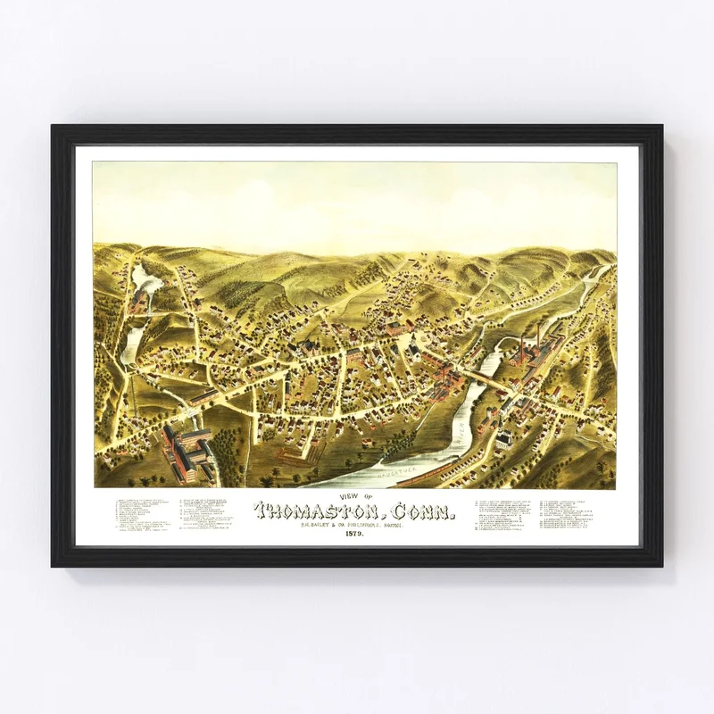
Step back in time with a glimpse into Thomaston, Connecticut, as it was in 1879. This vintage map from Litchfield County has been digitally restored to highlight every historic detail clearly and beautifully. It’s more than just wall decor; it’s a piece of history that adds character to any room. Whether it’s displayed in your home office or given as a thoughtful gift to a history lover, this map is sure to spark conversations about the rich local heritage it represents.
Crafted by hand for quality that lasts, our prints are constructed using high-end materials. Opt for the framed version and admire how solid wood stained frames enhance its traditional appeal. Prefer an unframed print? Enjoy it on premium matte paper instead! If you choose our canvas option, know it’s made with polycotton stretched over sturdy wooden bars for added durability.
No matter how you display your map of Thomaston from 1879, it’s ready to hang and share its story straight out of the box.
Reviews
There are no reviews yet.