
Description
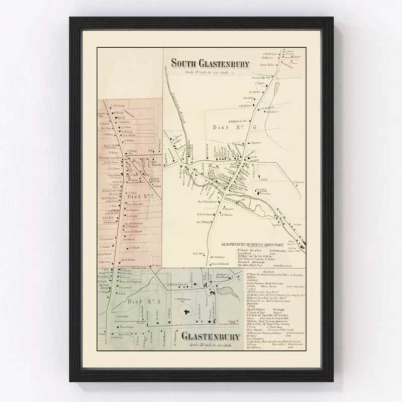
Discover the charm of a bygone era with this beautifully restored vintage map of South Glastenbury, located in Hartford County, Connecticut. Crafted from an original 1869 design, it brings a touch of history to any space. Whether you’re an enthusiast of local heritage or simply appreciate timeless decor, you’ll find this piece to be both fascinating and tasteful.
The quality speaks for itself; each print is ready to hang straight out of the box and comes framed in solid wood that’s carefully stained by hand. If you prefer the texture of canvas, our prints are handmade using polycotton stretched over durable wood bars. For those who choose unframed options, rest assured that they’re printed on premium matte paper.
This map isn’t just wall decor—it’s a conversation starter. Celebrate South Glastenbury’s rich past while adding classic flair to your home or office. It’s also an ideal gift for history buffs who love immersing themselves in local narratives.

Reviews
There are no reviews yet.