
Description
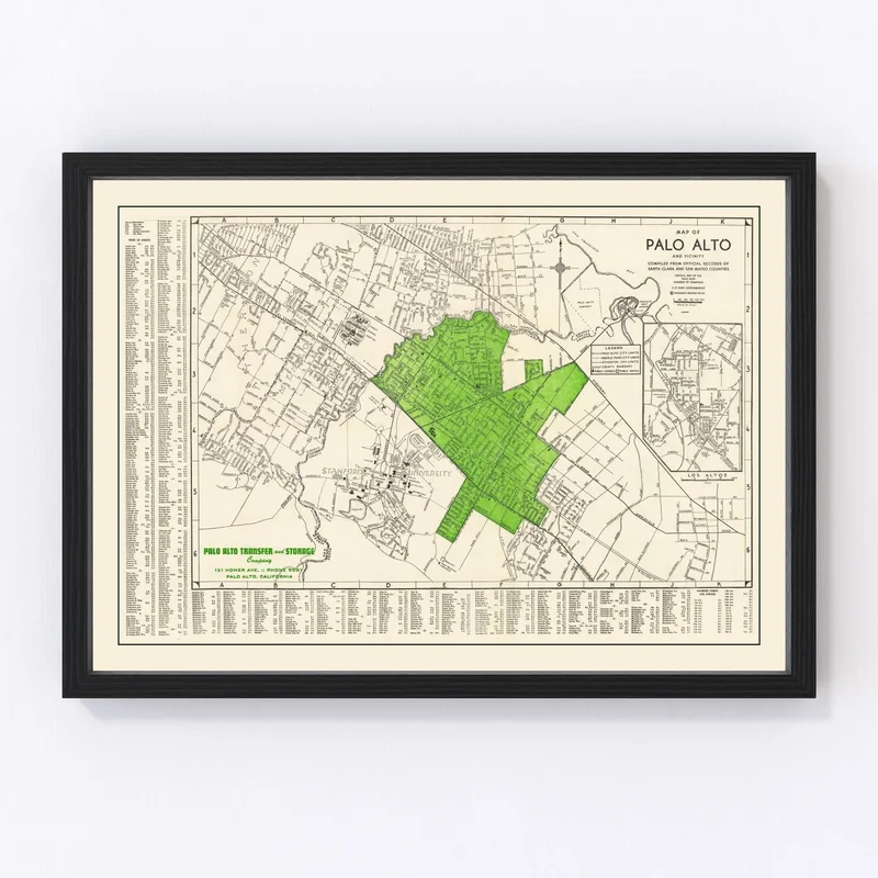
Discover a piece of history with our meticulously restored 1953 vintage map of Palo Alto, nestled in Santa Clara County, California. This print not only showcases the local charm of Palo Alto but also serves as a timeless tribute to its past. Whether you’re a history enthusiast or someone who appreciates unique décor, this piece is perfect for you.
Each print is crafted with utmost care and quality. If you opt for a framed version, you’ll enjoy the elegance of solid wood, expertly stained to complement any setting. Our canvas prints pamper your walls with polycotton canvas beautifully stretched over solid wood bars. Prefer an unframed look? You’ll receive your map on high-quality matte paper—ready to be admired.
This map is not just art; it’s an engaging centerpiece for conversation in any room—be it your home or office. Gift this exquisite snapshot from 1953 to anyone passionate about local history and watch their eyes light up with nostalgia and interest!
Reviews
There are no reviews yet.