
Description
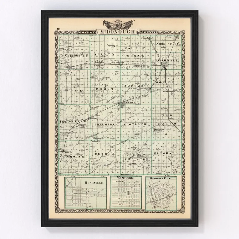
Discover a piece of history with our digitally restored 1876 map of McDonough County, Illinois. It’s a charming glimpse into the towns and landscapes of the past, featuring notable areas like Macomb and Bushnell. Whether you’re a history buff or just love unique decor, this map is sure to draw interest as both a nostalgic reminder and an engaging conversation starter.
Crafted with quality materials, it’s available in two finishes: framed or canvas. The frames are painstakingly constructed by hand from solid wood which has been beautifully stained for warmth. Our canvas versions are meticulously printed on polycotton canvas stretched over sturdy wood bars to give that classic look and feel. If you prefer an unframed option, they come printed on high-quality matte paper for that perfect vintage touch.
No assembly required either; our prints are professionally prepared for hanging right out of the box. Ideal as a gift or personal addition to your home or office—it celebrates not only local geography but adds timeless character wherever it resides.
Reviews
There are no reviews yet.