
Description
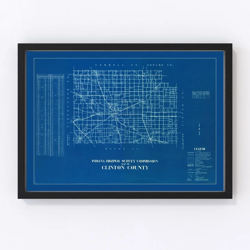
Discover the charm of Clinton County, Indiana, with this beautifully restored vintage map from 1936. Perfect for history buffs or anyone appreciative of classic design, this map offers a glimpse into the past while making an elegant addition to any room in your home or office. The quality shines through every detail, as each piece is constructed by hand using high-grade materials.
Whether you choose a framed print crafted from solid wood and stained to perfection, a canvas version stretched over solid wood bars, or an unframed print on premium matte paper, these maps arrive ready to hang and enjoy. Celebrate local history by spotlighting some of the county’s notable towns like Frankfort and Colfax.
This vintage map isn’t just décor; it’s a conversation starter that invites stories and memories connected to Clinton County’s rich history. It’s also an ideal gift for anyone with roots in Indiana or those who cherish their connection to such a storied area.
Reviews
There are no reviews yet.