
Description
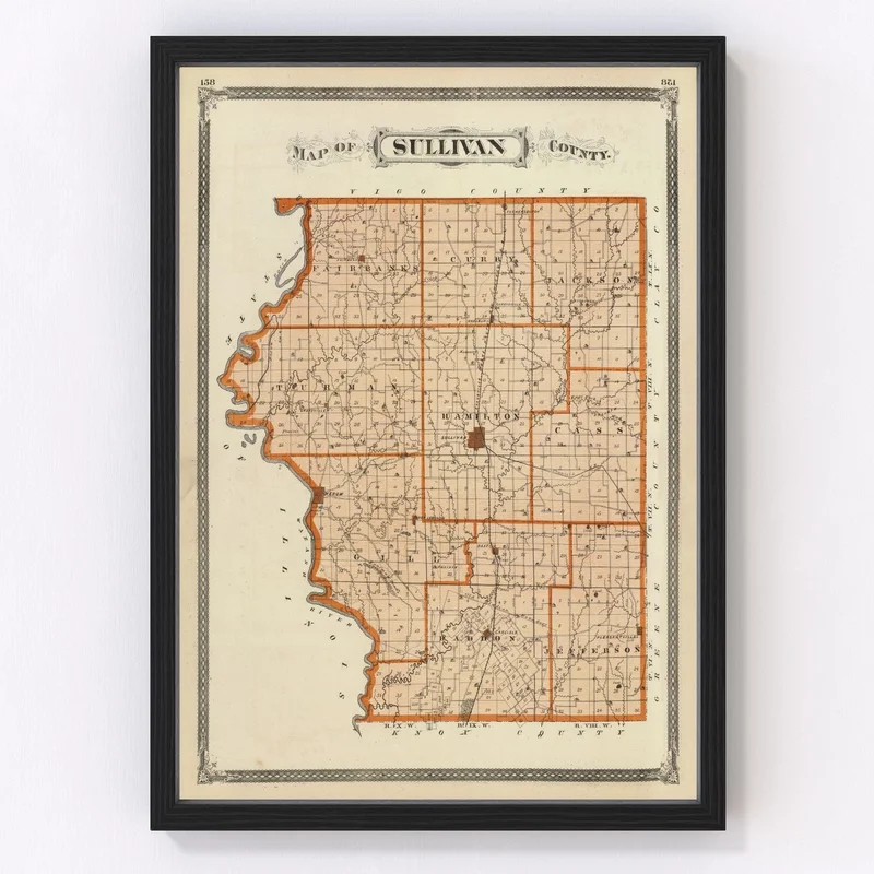
Discover a charming piece of history with our digitally restored 1876 map of Sullivan County, Indiana. Ideal for enthusiasts of local lore, this vintage map print makes an engaging addition to any home or office setting. It brings a touch of tradition and class while sparking conversation about the historical landscapes of towns like Sullivan, Farmersburg, and Carlisle.
This thoughtfully crafted print comes ready to hang and is available in various formats to suit your preference. Our framed versions boast hand-constructed solid wood frames with a classic stain finish, offering a timeless look that complements any decor. For those who prefer a canvas texture, our polycotton canvas prints come snugly stretched over durable wooden stretcher bars. If you favor the simplicity of an unframed option, our high-quality matte paper provides superb clarity and detail.
Explore the bygone days as you traverse these delicate lines and markings from 1876—a perfect gift for anyone fascinated by history or who holds cherished memories within Sullivan County’s borders.
Reviews
There are no reviews yet.